


Adams 212, Adams County, Colorado
About
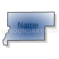
Outline

Summary
| Unique Area Identifier | 546396 |
| Name | Adams 212 |
| County | Adams County |
| State | Colorado |
| Area (square miles) | 55.42 |
| Land Area (square miles) | 54.94 |
| Water Area (square miles) | 0.48 |
| % of Land Area | 99.13 |
| % of Water Area | 0.87 |
| Latitude of the Internal Point | 39.85590860 |
| Longtitude of the Internal Point | -104.29123320 |
Maps


Graphs
Select a template below for downloading or customizing gragh for Adams 212, Adams County, Colorado


Neighbors
Neighoring Voting District (by Name) Neighboring Voting District on the Map
- Adams 206, Adams County, CO
- Adams 207, Adams County, CO
- Adams 208, Adams County, CO
- Adams 211, Adams County, CO
- Adams 213, Adams County, CO
- Adams 215, Adams County, CO
- Adams 216, Adams County, CO
- Adams 217, Adams County, CO
Top 10 Neighboring County Subdivision (by Population) Neighboring County Subdivision on the Map
Top 10 Neighboring Unified School District (by Population) Neighboring Unified School District on the Map
- Bennett School District 29-J, CO (6,203)
- Strasburg School District 31J, CO (4,796)
- Byers School District 32J, CO (2,469)